Planning for the “Edges” of Indian Cities
Humankind’s constant effort to fix its shortcomings is what drives human history. - Joel Garreau, Author of Edge Cities: Life on the New Frontier
Indian cities are growing at the “Edge”, and it is becoming increasingly necessary to prepare long term plans. No longer can urban planners dictate the future city, the way they are used to doing with master plans and other planning instruments. We require a new way of managing growth: rather than creating plans that require multiple revisions, we must plan for a city continues grows, changes, and adapts.
Post-independence growth largely occurred in the four metros, and growth was connected to the core (e.g. RK Puram in Delhi). During the 1990s, something new occurred in India: in addition to original cores (e.g. Connaught Place in Delhi; Nariman Point in Mumbai; Abids in Hyderabad), new cores started to emerge in the outskirts. Largely, these new cores are employment clusters, and the key growth drivers are the distance from the employment cluster, transport and availability of land.
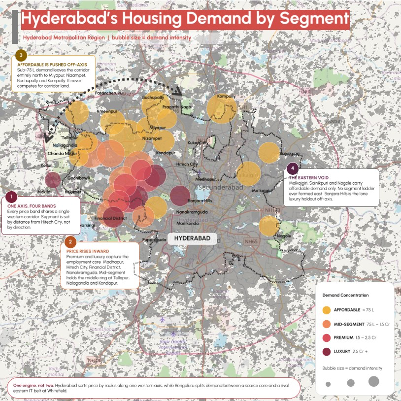
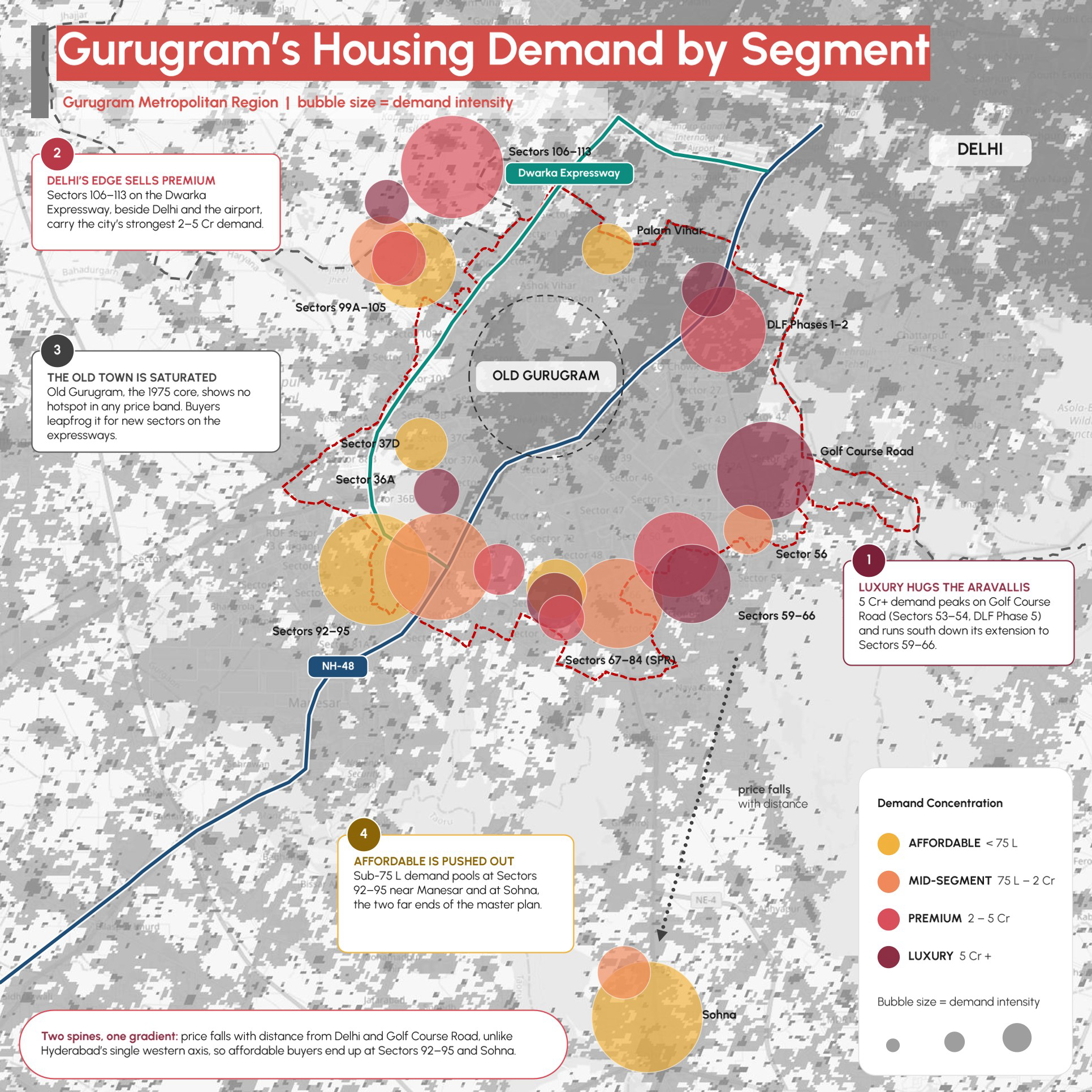
In these Indian versions of “Edge Cities”, investment hones in as if by chance, particularly on parcels of land, leaving the intervening parcels untouched. Let us see Hyderabad and Gurugram.
Hyderabad
(Source: Kartikeya Bhaskar)
As the map shows, the edge city is centred around Hyderabad’s new employment core: HITEC City, Madhapur, Gachibowli, the Financial District, and Nanakramguda. In housing there is a hierarchy with high-cost housing nearest to the employment centre, followed by the more affordable northern belt: Tellapur, Nallagandla, and Kondapur. Farthest from the employment centre (or now corridor) there is a major northern housing belt in Tellapur, Nallagandla, and Kondapur providing relatively affordable housing for service-sector workers, industrial labourers, and entry-level corporate employees.
Gurugram
(Source: Kartikeya Bhaskar)
In Gurugram, the edge city is developing around Golf Course Road, DLF Phase 5 and the southern extension toward Sectors 59–66. Naturally, high-cost housing is developing here, while the less costly housing is coming up along the Dwarka Expressway and affordable housing is available farthest from the employment core in Sectors 92–95 and Sohna. Importantly, development seems to have leapfrogged Old Gurugram, the historic urban core.
How to manage growth where the speed and scale of transformation often overtakes the assumptions embedded in the original city master plans or planning frameworks?
One way is to just make a grid around cities without prescribing every future home, commercial place or official space. Within this lattice, lakhs of unplanned decisions will occur. Soon the city will evolve beyond original intentions and urban planners will respond by reshaping the city Edge again.
So, what do urban planners do: they establish the framework, but what emerges within it is shaped over time by countless social, economic, technological and cultural forces that no urban planner can fully anticipate. Contemporary Indian urban thinking must start to look at cities as complex adaptive systems that evolve through interactions over time. Rather than trying to fix a predetermined image of the future city, planning must create a framework that lets the city grow, change, and adapt - all while maintaining a balance among people, place, economy, mobility, resources, and the environment. In this new way, urban planners will not design the city, but design its generator.